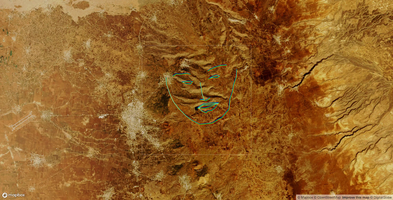
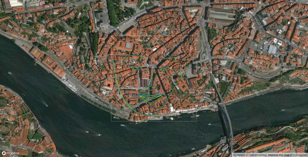
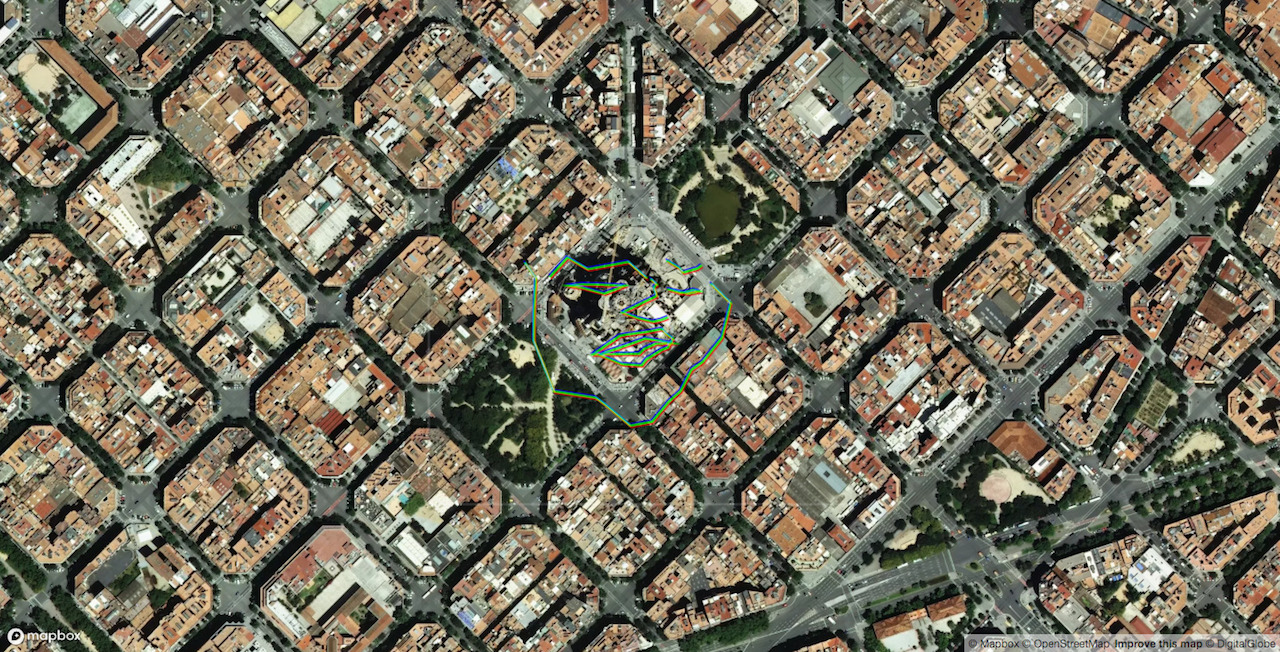
Geography of Hidden Faces applies AI to aerial imagery to “see” faces in the landscape.
At any given moment, dozens of satellite and aircraft sensors look down from above, taking pictures of the rapidly changing and evolving landscapes below. These images, stitched together, processed, and transmitted, become maps which ultimately come to shape the spaces and places they represent.
There is an ambivalence to the ways that these mappings constantly re-imagine and re-form the world. In the best cases, aerial images are used to help inform aid relief efforts after a disaster, expose the locations of fires, and create evidence pointing directly to critical environmental changes. Aerial images however are all too often used to exploit natural resources, displace native and indigenous peoples, and to justify the killing of innocent people.
How we interpret the “God's eye view”—its privileges, politics, responsibilities, and opportunities—is effectively how we draw the map. And with the unrestricted use of automated, machine learning-based systems for interpreting images, we only further codify our own problems and flaws, as well as our imaginations and politics onto the world.
Geography of Hidden Faces is a project about exploring and questioning what we see versus what we've trained computers to see. The project provides an interface to renderings of the world from above, layering both critique and a window into a kind of "algorithmic imagination." By applying facial recognition algorithms to aerial imagery, the project begins training you to see "algorithmically." Just as the algorithms have learned to identify patterns in their training data, longer engagement with this project begins to cue you in to the potential conditions and environmental factors that produce to a face detection in the landscape. By applying a facial recognition algorithm onto data it is not meant to interpret, we are given an opportunity to explore the quirky artifacts of facial recognition algorithms.
In 2013, Onformative Studio in Germany published their Google Faces project. Their investigation explored the phenomenon of pareidolia—the tendency for humans to see shapes or faces in inanimate or abstract objects and things—in machines. Onformative employed machine learning algorithms designed for face tracking, turning the gaze of the algorithms away from people and onto views of the earth from space.
Geography of Hidden Faces extends and reinterprets Onformative's early work. Here, the application prompts viewers to zoom and pan in such a way that with each interaction, they are left gazing into the map wondering if the AI sees anything more than what is in view.


